Belgium is once again leading the way in introducing a brilliant new idea: point-to-point walking. They’ve had bike knooppunten for years, and recently began to make routes for walkers, based on numbered signs, an online map, and the possibility of devising and printing your own walk. Here in the Netherlands we’re busy catching up, and our signposts aren’t yet as thick on the ground. Utrecht is as always at the cutting edge, and therefore the point-to-point system here is already fairly well developed. We thought we’d put together a walk starting at our newest train station, Utrecht Vaartsche Rijn, following a tiny, winding tributary of the Rhine to an 18th-century former estate (now a public park), along one of the forts from the New Dutch Water Line (started in 1815 – see below), the site of a Roman fort, and back to the station with a snack stop on the way.
Just find this mural at the foot of the Oosterkade, next to the train station. The blue-on-orange arrow on this signpost is part of the point-to-point system. It just means to go this way and you’ll get to the numbered point sign. The first point to find on this walk is #83.
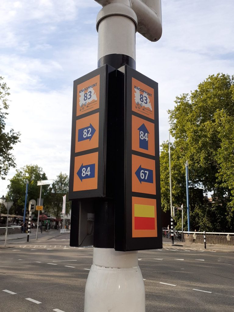
You can see how easy this makes it for us to describe the walk. Here’s knooppunt 83, on this traffic light pole. From here our walk goes right, to point 82. You see how other directions are indicated. This also shows the yellow-over-red regional walk. Should one be feeling peckish, this southern point of the medieval city is rich with food and drink opps, open even now in the corona-era. A favorite of ours is the Louis Hartloper Complex, the art deco former police station, now cinema and café. It is open again, and you can even go to the film if you reserve ahead. The seating is limited – the majority of seats are taped off – to preserve the 1.5 meter distancing.
At each numbered pole, it’s easy to follow the arrow to the next number on your route. Turn right here and keep the water on your left. You’ll see one of the forts at #82, and Utrecht’s football stadium on your left between points 82 and 18. As you pass under the freeway after point 78, you’ll find yourself in Amelisweerd park.
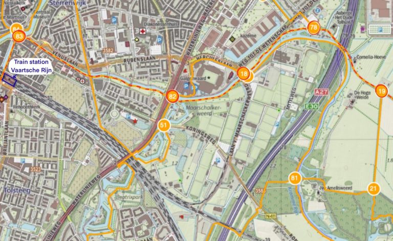
It’s all more serene and less urban than it sounds. On this southern end of Utrecht the countryside begins quite close to the city. That is thanks to the forts. On this map you see four of the forts of the New Dutch Water Line defense. In all there are 60 forts and bunkers, from south of the Waal river, northwards to the IJsselmeer east of Amsterdam. Plains around the forts could be quickly flooded to impede the progress of an invading army. The use of planes in WW I made the Water Line obsolete, but many of the forts are still in use…. for scouting and outdoor theater. And they can be important for wildlife: we attended a talk about bats at Fort Rhijnauwen. The moats around the forts, being quite shallow, are now a dependable ice skating venue in winter, now that the warmer climate has eliminated the famous Dutch skating races.
The presence of the forts at Utrecht’s southern edge limited building. The city more or less stops here, and the countryside begins.
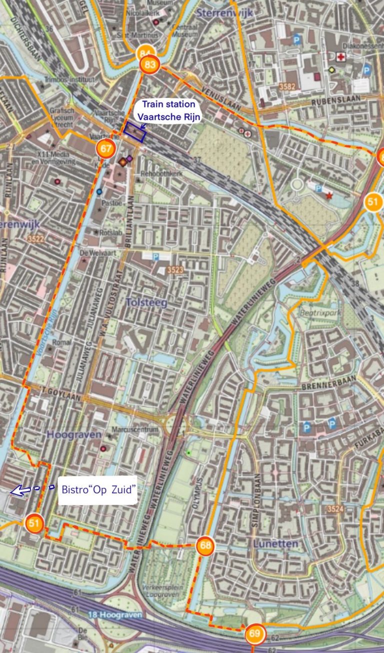
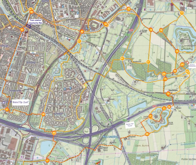
So here’s the route in its entirety: station – 83 – 82 – 18 – 78- 19 – 75 (lunch stop hors de piste at Theehuis Rhijnauwen) – 24 – 22 – 93 – 73 – 72 – 35 – 0 – 41 – 36 – 71 – 69 – 68 – 51 – (drinks at Op Zuid) – 67 – station.
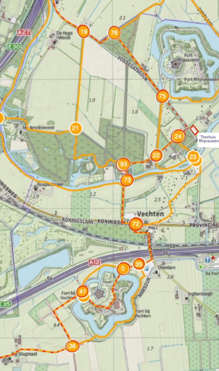
Once we’ve reached point 19, we’re really in Amelisweerd Park. This feels like countryside, even though you still hear traffic. Building the A27 freeway took a big bite out of the land of the original estate and the road is audible from within the park. Last year the province proposed works to broaden the motorway, shrinking the park even further. but happily this proposal was defeated. (Yay!)
From point 75 we have a view of the largest of the forts, Fort Rhijnauwen. From there we would certainly continue straight ahead to the teahouse for a bit of refreshment.
Theehuis Rhijnauwen has lots of outdoor seating, a view of the river, excellent beer on tap, and every conceivable type of Dutch pancake (see our article ‘Hollandsche Rading to Baarn’ for info on pancakes). Oh, and tea.
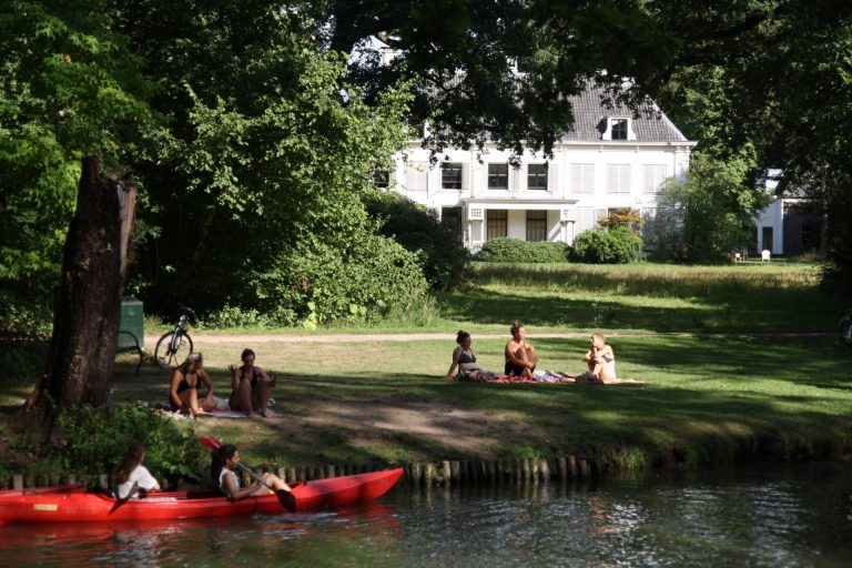
Locals relaxing on a summer’s day on the lawn before New Amelisweerd, built in the 1680’s to replace the damaged, medieval manor.
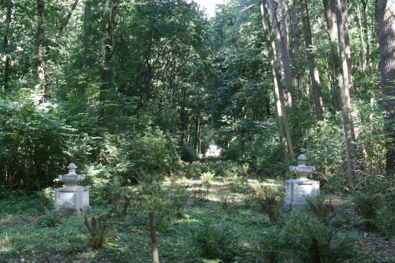
These two gateposts show where the drive to New Amelisweerd once ran. The house is the white splotch in the distance.
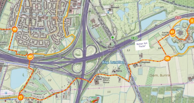
After lunch and a refreshing drink, it’s now a good time to have a look at Fort bij Vechten (points 0 and 41), and the site of the Roman fort. Built during Augustus’ reign in around 4 A.D., this was part of the northern border, or limes, of the empire. Most of the 10,000 or so objects excavated here can be found in Utrecht’s Centraal Museum, while reproductions of some of these are on display at the site.
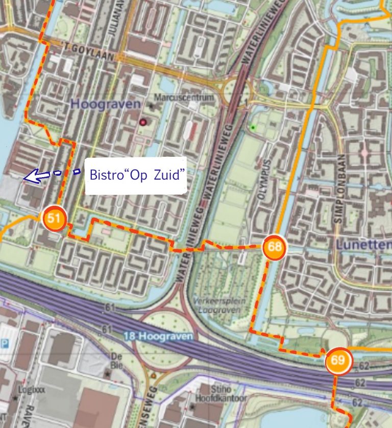
Once we get to point 51, it might be wise to pause for yet more refreshment.
This bistro right on the water is a well repurposed steel and wire factory building. The bistro is on the expensive side, but a cool drink probably wouldn’t break the bank, and it’s awfully pleasant. We then make our way up the ‘Vaartsche Rijn’ canal back to the station.
Here’s the whole map in one go:
Afterword
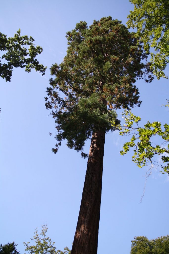
The current Dutch topographical maps no longer have a symbol for ‘remarkable tree’ as they used to. This sequoia sempervirens certainly is remarkable – and how pleasant it is for us California natives to meet it here, on the grounds of New Amelisweerd.