After years of absence from the site basically due to being busy, we have both lost much of our work because of the virus. This has given us the gift of time and the motivation to get out and walk close to home. We were not supposed to be on public transport until June, and even now it’s tolerated but not actively encouraged, so we’ve been good citizens and stayed away. We have had some lovely walks and made some great new discoveries, many of them practically in our own back yard. And we’d like to share them with you.
The “Limes” route – transporting gin and limes along the borders of ancient Rome
No, we’re not making this up. When all was normal, a Boots and Bowtie walk was rural-scenic and involved a gastronomic element (past walks have included a farmer’s market, brew pub, and a cozy restaurant in the woods). In the coronavirus age, our walks have mostly been right around here and too short to involve eating. So are we scraping the bottom of the barrel by telling you we hiked to a big-box megastore in a light-industry zone south of town to buy gin and limes? Does it make it any more interesting if we mention we went partly along the former northern boundary of the Roman Empire?
Find Utrecht’s Oude Liesboschweg (starting at the rail line and going south) and the Makro store in Nieuwegein on the electronic map of your choice, and you’ll notice that it’s very green just about all the way. Not nature-reserve green all around you for miles, and you do have to cross over the A12 freeway. That said, there was a lot of pretty scenery, especially now (late May) with trees in leaf.
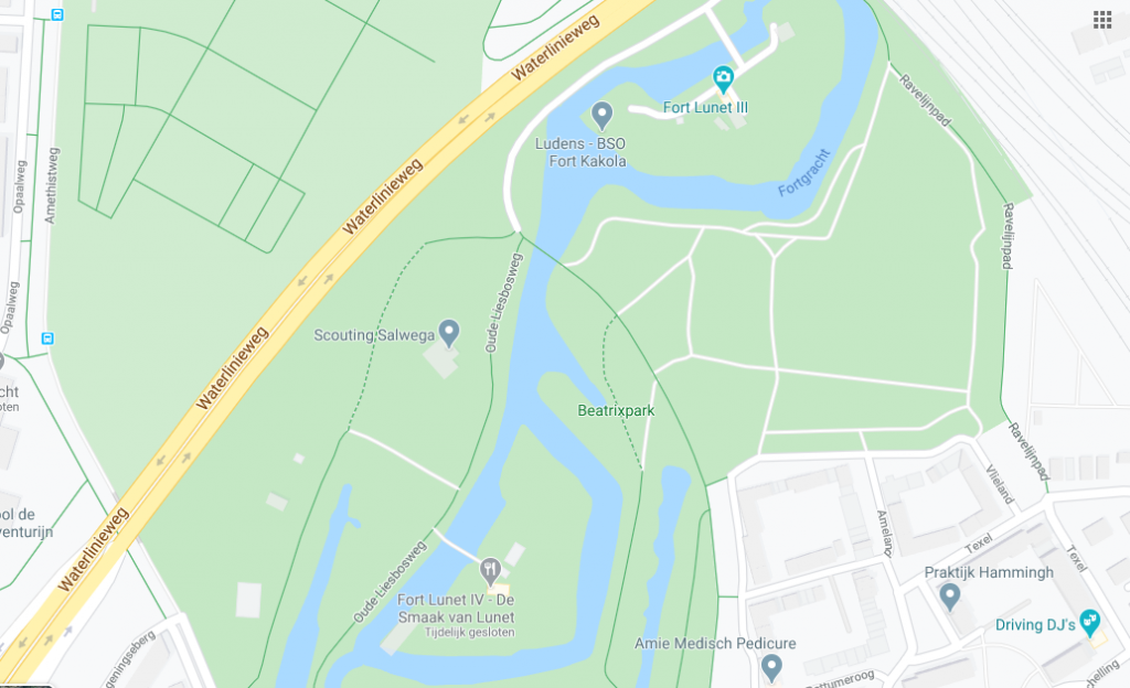
Oude Liesboschweg begins at the entrance to Fort Lunet at the top of the map
We had pretty much decided on biking somewhere, but then we realized that it was going to be a sultry gin-and-tonic kind of evening, and also that we were out of gin. Mr. Bowtie proposed walking to a big-box store south of us, pointing out that it was an extension of one of our regular routes, which at a good clip takes an hour round trip. Mrs. Boots was doubtful but agreed to give it a shot if only for the sake of variety.
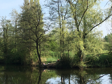
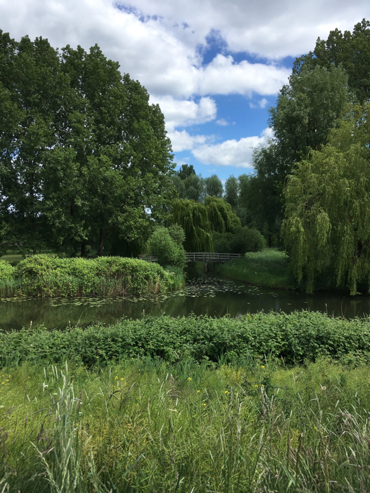
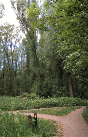
Our first stage down the Oude Liesboschweg (only for bikes and pedestrians) passes one of the forts that were once part of a 19th-century defense line that could be flooded should anybody think about invading from the east. (They didn’t mention any names then, and we’re not mentioning any now.) Its moat continues as a canal which is part of the Beatrixpark, and there are lots of waterfowl nesting and corralling their young there right now. Our city has a policy of mowing later in the season to help out the insects, so right now the grass is high and full of wildflowers in bloom. From some spots in this park, you can’t see houses or infrastructure and if you were hard of hearing you could almost imagine yourself in the countryside.
After crossing the A12, you skirt around an artificial lake called the Plas Laagraven. It’s nothing to write home about in terms of flora/fauna, but you are at an Elevation and it feels good. This ability to look down on something from where you are can be elating and should not be scoffed at.* They’ve planted some birch saplings on the ridge, which in a few years should offer some shade but don’t at the moment.
At the end of the lake you come to an intersection with a paved road. After two right turns and another half km we entered the Makro parking lot, where the ill-managed bottleneck of people entering and exiting made us apprehensive, but once inside, we felt like tiny ants in an emporium of a size you rarely find in the Netherlands (your average Wal-mart, say) since space is at such a premium here.
This place was originally a wholesaler and you used to need a tax number to get in, but now you can just go in for, say, one or two limes and nobody bats an eye. It is not a place to linger, though, so we grabbed our limes and gin and were out of there.
The route back was the same except that we took in the path along the salamander pool. Since something like 2008 a group of volunteers have maintained a wetland pool, more or less next to the freeway but shielded by trees, that is home to salamanders, frogs, and the critters on either side of them on the food chain. And the maintenance looks pretty minimal; refreshingly, it looks like they’re just trying to give nature some room. The path alongside it is part of a new long-distance path (see wikipedia article or google “European long-distance footpaths”) called the Limes – meaning limits, English speakers say “LEE-mess” – along what was once the northern boundary of the Roman Empire.
And soon we were home, doing with our gin and limes just what you’d hope. Cheers!
